Choose your language:
Land Survey

UAV - Unmanned Aerial Vehicle

Drone pilot

UAV - Unmanned Aerial Vehicle

Aerial Survey Drone 

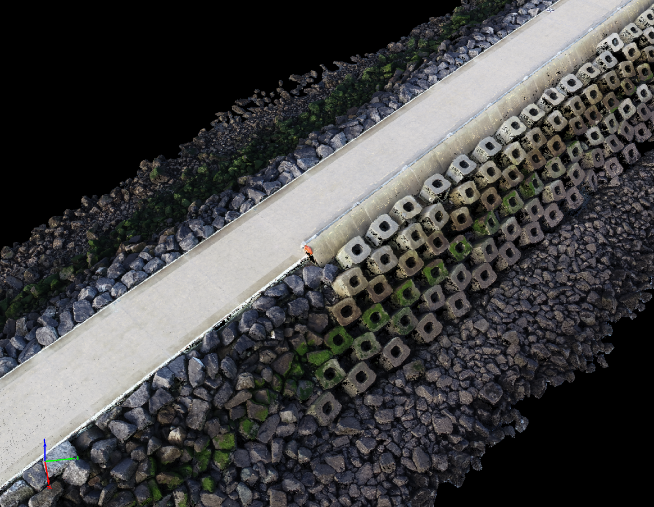
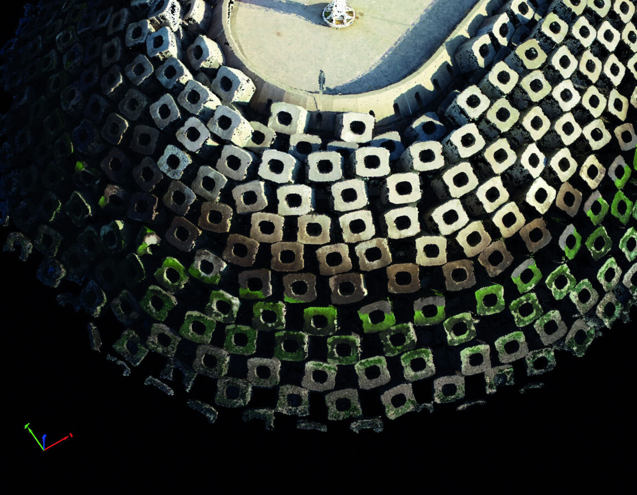
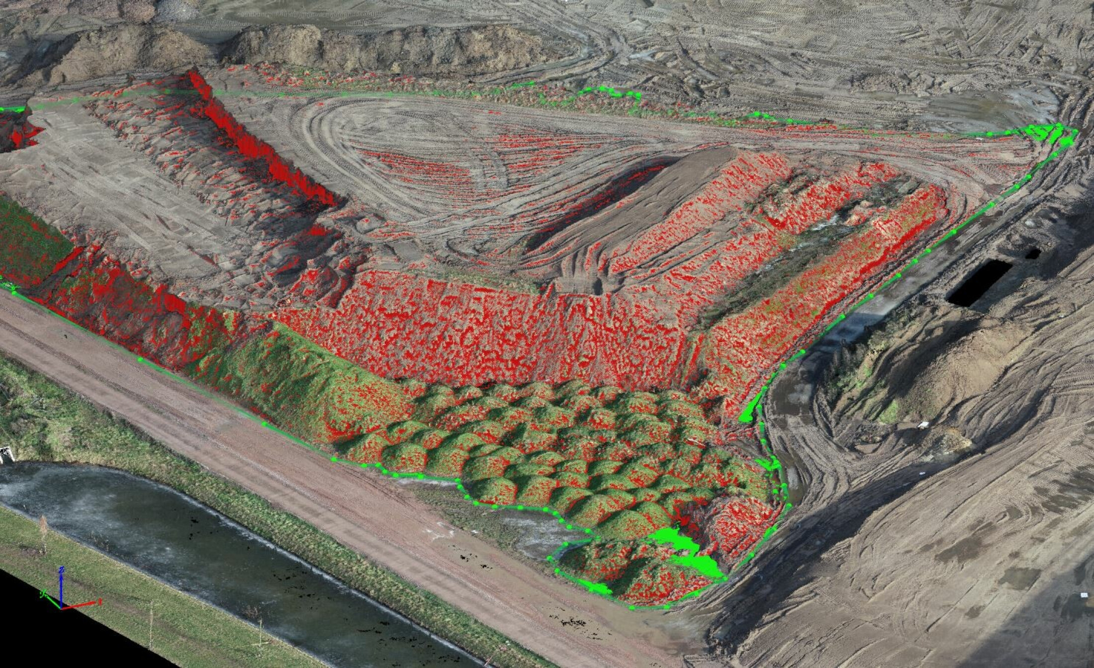
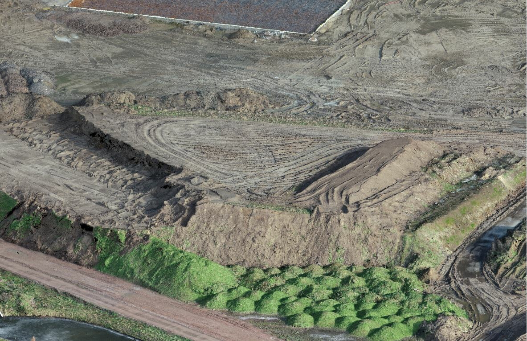
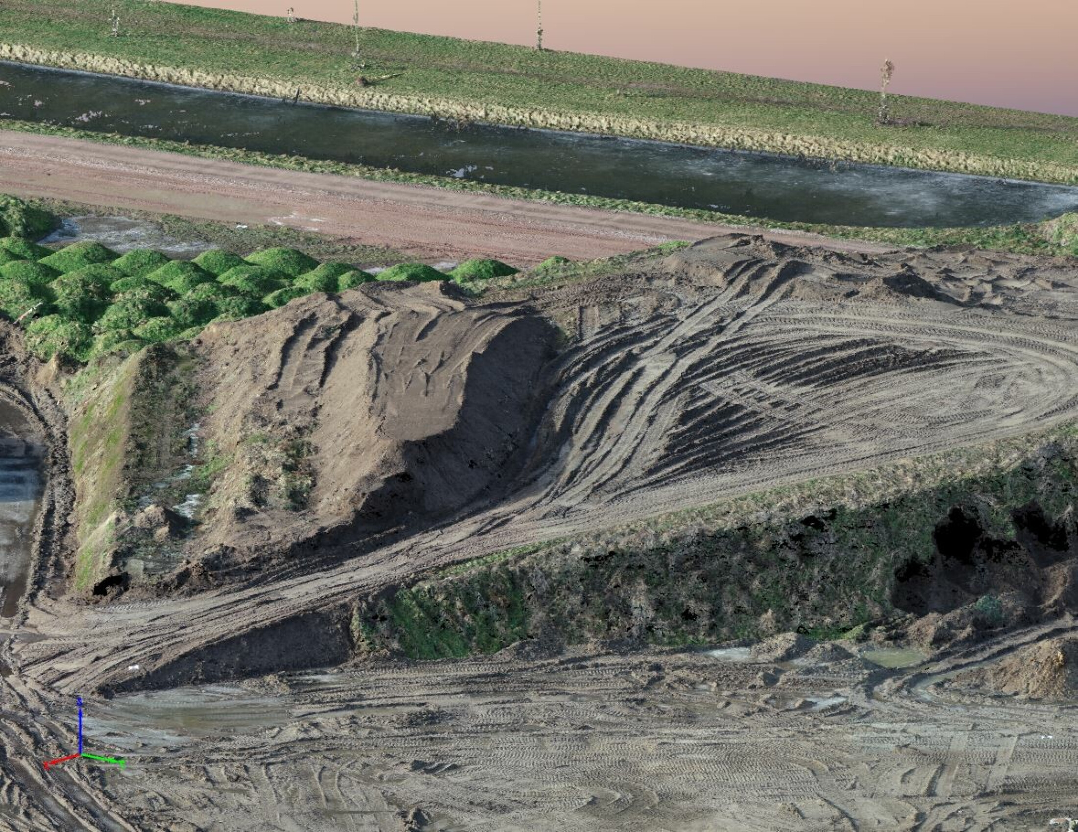
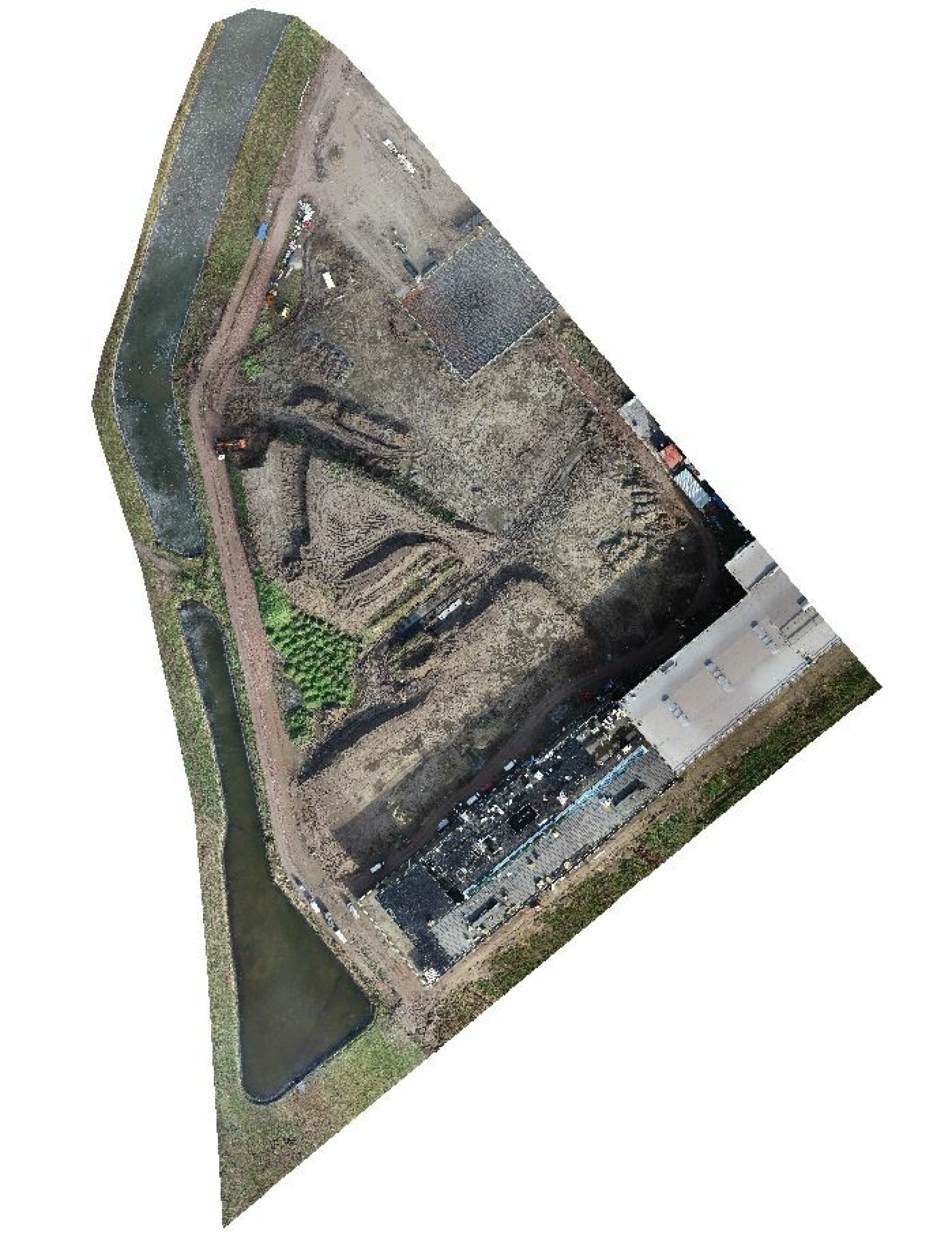
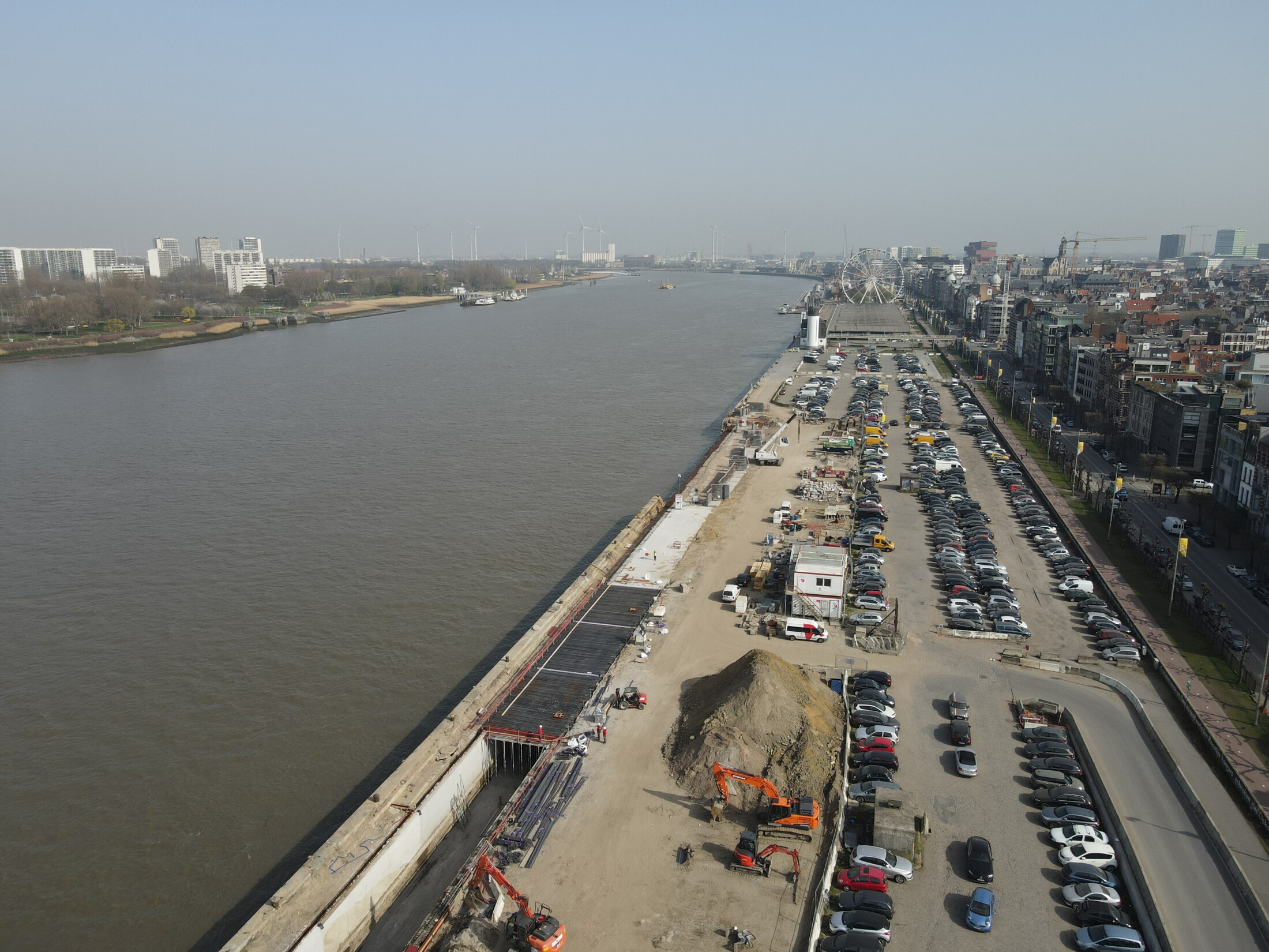
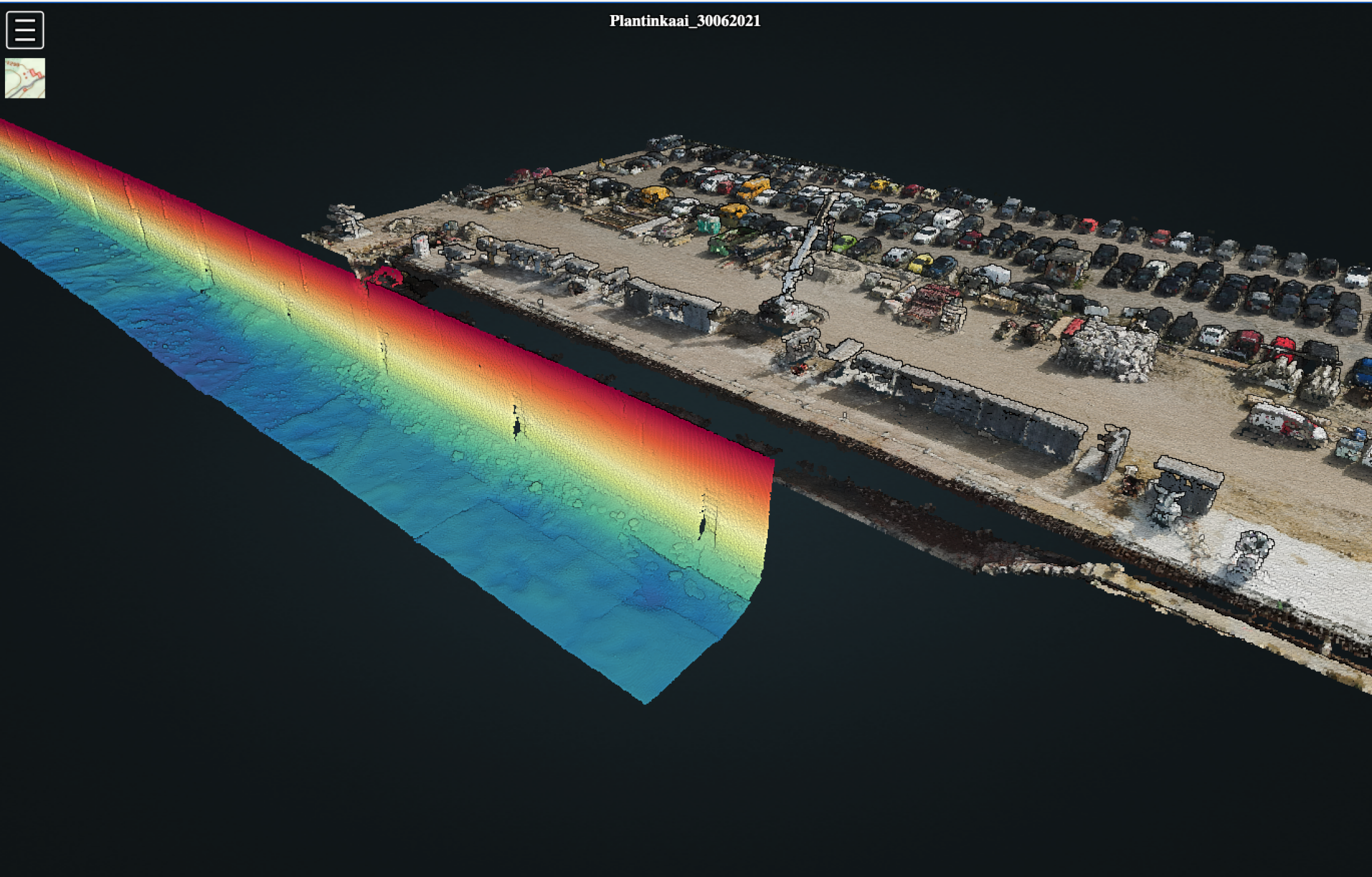
GEOxyz’ Unmanned Aerial Vehicles (UAV) platforms can provide access to areas that are too difficult or too risky to send your team into. These services can dramatically reduce the risk exposure on projects and by altering the economics of these surveys, can enable you to do them more frequently. The Drone Survey produces data from the camera or sensor payload. After interpretation, these can be stored / archived for future reference and used to compare datasets over numerous years.

OUR SERVICES & SOLUTIONS 

Using our fleet of professional unmanned aerial vehicles, sensors, processing software and in-house experienced pilots, GEOxyz is able to provide a variety of advanced remote sensing services.

1   Aireal Survey   Mapping

Aerial Survey & Mapping  

Using a combination of photogrammetry and lidar on a variety of drones, GEOxyz is able to rapidly survey specific areas to acquire high-resolution aerial images and geospatial data.

We provide everything from pre-flight planning, to data acquisition and analysis, to post-processing for your requested use. 

Examples of work products our image data can be used for:

• Orthomosaics

• Topographical Survey / River Mapping

• 3D Models

• Volumetric calculations - Quickly and safely calculate volumes.

• Progress Monitoring

drone wind inspect

DRONE inspections

In industries where regular equipment, structure, and site inspections are necessary but accessibility and safety is a concern, drone inspections are an excellent alternative

Inspections by a UAV are a quick and cost-conscious inspection method which enables access to otherwise inaccessible structures, offering an alternative to more traditional, time consuming and costly inspection methods such as helicopter, rope access, sky-lifts, cherry pickers and scaffolding.
Our drones provide a close and detailed look, allowing you to detect impending damage and signs of wear in advance and improve your maintenance strategies.


2   Powerline2

Powerline Monitoring

Powerline inspection using drones, can cover immense portions of surface in each flight and provide accurate visualization of the powerline components as well as surrounding objects.

DJI 0830b

Critical Infrastructure Inspection

• Wind Turbines 

• Bridges 

• Towers 

• Buildings

Critical Infrastructure, often located in hard-to-reach areas, requires damage spotting in order to detect, react to and repair problems quickly, with minimal influence on the asset performance or the environment.

4   flyability   Elios 2

Confined Space Inspections

Inspecting/surveying tanks and confined spaces can be a risky enterprise. We have the capability to complete remote inspections in such spaces, keeping the inspection team outside the hazardous environment.

To optimize inspections and survey operations in such confined spaces, special designed collision tolerant drones that have an on board illumination system and a thermal camera to enable it to adapt to this challenging environment. 

Confined Space inspection project 

5   Picture MAG Drone

MAGNETOMETRY

Using a specially equipped ‘Magdrone’, GEOxyz can rapidly acquire accurate magnetometry data. Drone-based magnetometry is exactly what it suggests, a magnetometer flown beneath a suitable drone to allows for rapid data collection in difficult to access terrains such as marshes and intertidal areas.

Benefits:

• Accurate survey lines (using RTK precision)

• Fast data collection over all terrains

• Smooth data collection without sudden sensor movements (due to uneven ground)

• Surveys over water and boggy terrain (unsuitable for cart)

• Surveys over slopes and precarious land features (safety perspective)

• Provides scout capability to quickly evaluate large areas economically

6   Echsosounder   courtesy Valeport

BATHYMETRY

Drone Bathymetry is the act of using a drone and a sonar to measure (map) the depth of water in oceans, rivers, or lakes. 

Our drone-suspended single beam echosounder allows us to collect accurate water depth (bathymetry) data in water depths as shallow as 0.1m. 

Applications:

• Small and/or shallow Lakes and Rivers

• Hard to reach locations/no points of entry

• Seaweed, debris, mechanical pollution 

• Drinking Water reservoirs (no boats)

7   Lidar Topodrone

AERIAL LASER SCANNING 

LiDAR 

Airborne Laser Scanning (ALS, also known as LiDAR - Light Detection And Ranging) probably is the most precise and efficient method of remote sensing. This technology can collect accurate data no matter what light conditions are on a given day. The LiDAR can even capture points on the ground surface through vegetation in greater detail than 3D data reconstructed with photogrammetry techniques.

Our laser scanner equipped UAV’s are used to make high-resolution point clouds of terrain, which makes them ideal for a wide variety of applications including corridor mapping, forestry, civil engineering, environmental monitoring (e.g. monitoring river delta sedimentation or coastal erosion) and construction, among others.

IMG 20220609 110154

OUR TECHNOLOGY  

Professional & Versatile lnspection Drones, including:

DJI Phantom 4 Pro V2.0

DJI M300 RTK

• Flyability Elios 2

GPS, PPK and RTK positioning options on all drones.

Our inspection drones can carry a variety of sensors on fully stabilized precision gimbals in different possible configurations:

• Single downward camera

• LiDAR

• LiDAR + Downward Camera

• Thermal Camera

Live, constant and interactive control of all cameras.